- Duration
- 12 days
- Pace
- Active
- Hotel changes
- 6
- Best months
- Jul, Aug, Sep
- From
- $1,500 per person
What you get is high glaciated country directly above a city of two million, alpine lakes at 5,900 to 9,800 feet (1,800 to 3,000 m), passes on old herding routes, and a southern range near Shymkent that almost nobody walks. What you do not get is a hut system, waymarked long-distance routes, or crowds. Two of those three are advantages.
Who it suits: fit walkers happy with five to eight hours a day, height gains of 2,000 to 3,500 feet (600 to 1,050 m), and three nights under canvas. No technical ground and no glacier travel on this route. Some previous mountain experience assumed.
Your specialist: Paz Prosianoy or Osnat Angerman here, with our long-standing Almaty partner and their mountain team on the ground.
Day by day
Day 1: Arrive Almaty. Transfer and a rest day. Evening briefing with your mountain guide: route, weather, kit check, what goes in the duffel and what stays in Almaty. We store a bag for the whole trip.
Day 2: Acclimatisation above the city. The cable car to Shymbulak at about 7,400 feet (2,260 m), then walking up to the Talgar pass at about 10,300 feet (3,140 m), five to six hours with a good deal of ascent. It is a real day and it is also a diagnostic: your guide sees how the party moves before committing to anything remote. Back down to Almaty for the night.
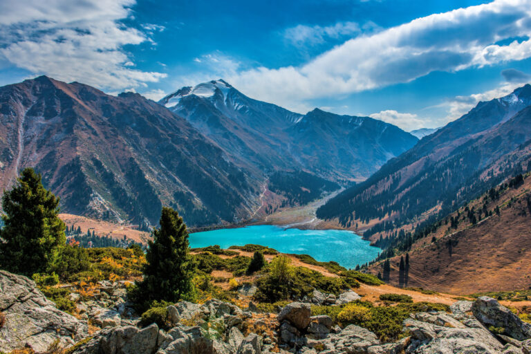
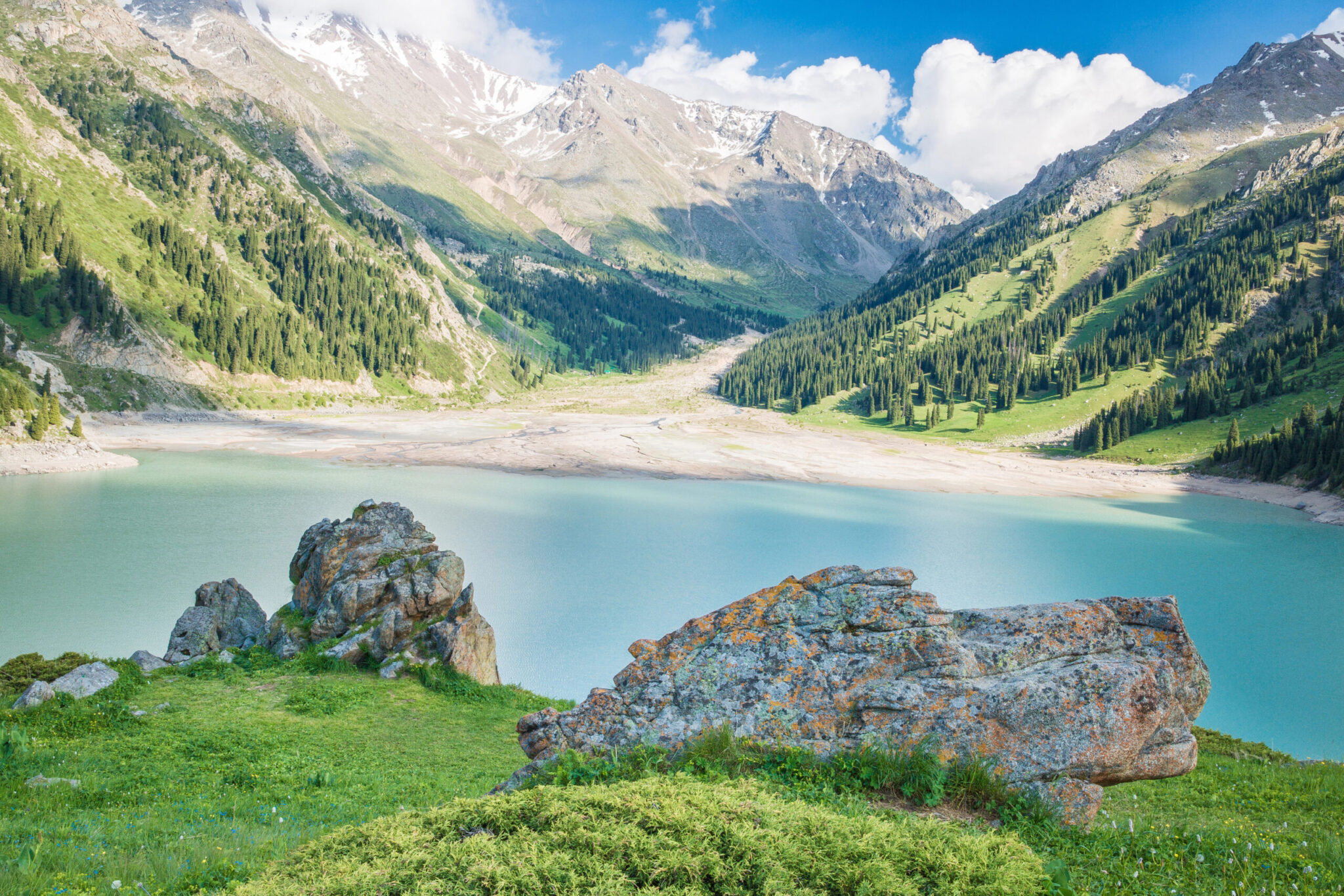
Day 3: Big Almaty Lake and the Kosmostantsiya. Up the gorge road to the lake at about 8,200 feet (2,500 m), then on foot past the observatory towards the Zhusalykezen pass at about 11,200 feet (3,400 m), six hours. Second acclimatisation day, higher. Night at a mountain guesthouse above the lake rather than back in the city, which is the point: you sleep high.
Days 4 and 5: The Turgen valley. East to the Turgen gorge, then two days walking in it: waterfalls in the lower valley, then up to the Assy plateau at about 8,500 feet (2,600 m), a summer pasture where herders still bring flocks, with a night in a tent on the plateau. Six to seven hours a day. This is the emptiest part of the route and, for most people, the best.
Day 6: To Saty. A transfer day, four hours east and south, with Charyn canyon in the afternoon on the way. The Valley of Castles is a ninety-minute walk on the floor of a red sandstone gorge and it is a good recovery afternoon. Guesthouse night at Saty.
Days 7 and 8: The Kolsai lakes. The first lake at about 5,900 feet (1,800 m), then the walk up to the second at about 7,600 feet (2,300 m), four hours, and camp there. Day 8 goes on towards the third lake at about 8,900 feet (2,700 m) and the pass above it towards the Kyrgyz frontier at roughly 11,000 feet (3,350 m), seven to eight hours, then back down to the second lake. Note that the pass itself is a border area and we walk to the viewpoint below it, not across it. Second camp.
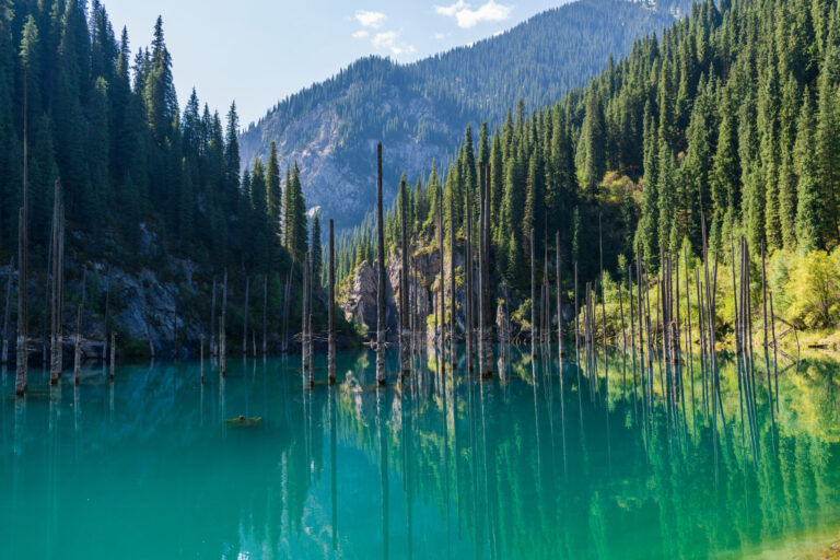
Day 9: Kaindy, and back to Almaty. Down to Saty in the morning with a detour to Kaindy lake, where a landslide in 1911 drowned a spruce forest and the bare trunks still stand out of the water. Then five hours west to Almaty. A hotel, a hot bath and a good dinner, which after five nights of mountain food is the correct order of priorities.
Day 10: Fly to Shymkent, into Sayram-Ugam. An hour and twenty minutes south, then two hours east into the Sayram-Ugam national park and the edge of Aksu-Zhabagly, the oldest nature reserve in Central Asia. Guesthouse in a village at the foot of the range.
Day 11: The Aksu canyon. A full day walking with a ranger: down into the Aksu canyon, which is around 1,600 feet (500 m) deep, and back up the far side, seven hours with serious height loss and gain. Juniper forest, griffon vultures, and if you are lucky the tracks of something larger. Very few visitors walk this. Second village night.
Day 12: Shymkent, and out. Back to the city in the morning, the bazaar, and an afternoon flight to Almaty for the international connection, or a direct departure if your routing allows.
What is included
Eleven nights of accommodation, including three nights camping with tents, mats and a cook, and five in simple guesthouses, all meals on the walking days, a licensed English-speaking mountain guide throughout, a ranger on the Aksu day, one internal flight, private vehicles with drivers on transfer days, 4×4 access on the Kaindy, Assy and Big Almaty Lake roads, all park permits and border-zone paperwork, a stored bag in Almaty, a satellite communicator carried by the guide, a day-by-day document with honest walking times and height gains, and a WhatsApp group with your consultant and our Almaty partner team for the whole trip.
What we would change, and when
- Want a longer continuous trek? The Kolsai to Issyk-Kul crossing into Kyrgyzstan is a real route over a border pass, and it can be walked with the right permits arranged well in advance. It turns this into a two-country trip of about sixteen days and we will build it if you ask early.
- Want the desert instead of a third range? Swap Sayram-Ugam for four days in Mangystau, flying to Aktau. It is not walking country in the same way, but for landscape it is the most extraordinary part of Kazakhstan.
- Do not want to camp? The Turgen and Kolsai sections can be done from guesthouses with longer days and a vehicle meeting you. You lose the plateau night, which is the best night of the trip.
- Travelling in June? The high passes above Kolsai and Big Almaty Lake often still hold snow. We will build a lower version and upgrade on the ground if conditions allow.
Honest notes
There is no trail infrastructure and no hut system. The paths are herding tracks and old Soviet survey routes, they are not marked, and they are not on most maps. That is why you have a local mountain guide rather than a route description, and it is also why you will not meet anyone.
Border zones are real here. The passes above Kolsai run towards the Kyrgyz frontier and parts of the range near Sayram-Ugam sit close to Uzbekistan. Permits are required, we arrange them, and they take lead time. We do not walk across a frontier without the paperwork, and no guide worth using will.
Camping is proper camping. Tents, mats, a cook, a river to wash in, and no facilities. The food is good. If that is not what you want, say so now and we will build the guesthouse version.
Altitude is modest but not nothing. The high points here are 11,000 to 11,200 feet (3,350 to 3,400 m). Most people are fine. The first two days are structured as acclimatisation for exactly this reason and they are not padding.
Weather closes things. Afternoon storms above 9,800 feet (3,000 m) are normal in July and August and the guide will start early and turn around when needed. Your document carries a written alternative for every high day.
Built by your named Kazakhstan specialist.