Most people who say they are walking the Kumano Kodo mean one specific route out of five. This article explains which one, and which of the others might suit you better.
The five routes, compared
| Route | Days | Difficulty | Accommodation | Who it is for |
|---|---|---|---|---|
| Nakahechi | 3 to 5 | Moderate | Good, family-run, spaced correctly | Almost everyone |
| Kohechi | 4 | Hard | Sparse, long gaps | Experienced hill walkers |
| Iseji | 5 to 10 | Moderate, fragmented | Variable | Second visits, coast lovers |
| Ohechi | 3 to 4 | Moderate | Thin | Walkers who want nobody at all |
| Omine Okugake | 5 plus | Severe | Mountain huts | Serious mountain walkers only |
The Nakahechi, and why we use it
The Nakahechi is the imperial route, running west to east from Takijiri to the Kumano Hongu Taisha shrine, and it is the one we build with. Not because it is the easiest, although it is among them, but because it is the only route where the walking, the accommodation and the transport line up correctly for a visitor who has flown in from the other side of the world.
The four walking days as we run them:
Day one, Takijiri to Takahara. About 3 miles (5 km) and the shortest day, but it starts with a steep climb straight off the road. Takahara sits on a ridge with a view over the valley and mist in it most mornings. A gentle introduction that is not flat.
Day two, Takahara to Chikatsuyu. About 6 miles (10 km) through cedar forest, past small shrines and tea house ruins, on rolling ground. This is the day the route settles into its rhythm.
Day three, Chikatsuyu to Hongu. The long one, about 9 miles (14 km) with a real climb, finishing at the Kumano Hongu Taisha and the enormous torii gate on the old river flat below it. You arrive tired and you arrive somewhere that has been the spiritual centre of this landscape for a millennium.
Day four, Hongu to Nachi. A river boat down the Kumano-gawa, which is how pilgrims of rank travelled it, then the final climb up the Daimon-zaka stone steps under cedars to Nachi Taisha and the tallest waterfall in Japan, a single drop of 436 feet (133 m).
You can walk more of it and you can walk less. Two days from Chikatsuyu to Hongu is a satisfying short version.
The Kohechi, for people who want it harder
The Kohechi runs north to south, from Koyasan down to Hongu, and it crosses three passes over 3,300 feet (1,000 m) in four days. It is the direct route, which in this country means the steep one.
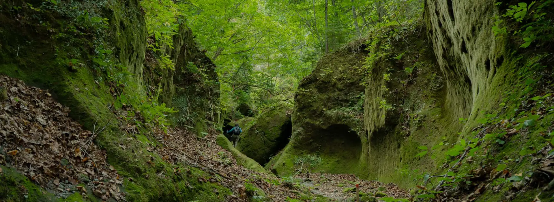
It is a serious walk. The climbs are long, the descents are hard on the knees, and the gaps between beds dictate the stages rather than your preferences. In exchange you meet almost nobody, and the section over the Obako pass is the finest forest walking on the peninsula.
We build it for walkers with real hill experience who tell us plainly what they have done before. We do not build it as a first Japanese walking trip.
The Iseji, the coastal one
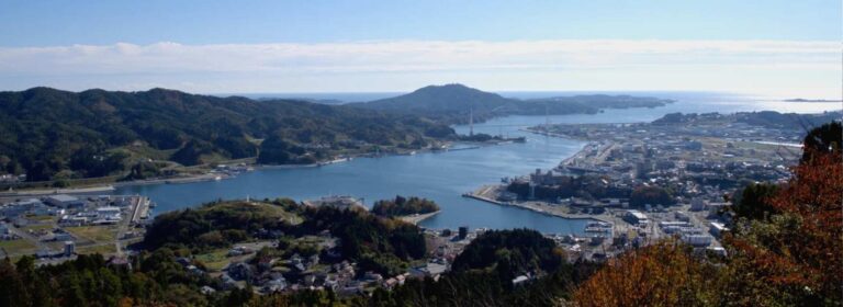
The eastern route, from the Ise Grand Shrine down the coast to Kumano, and the one that feels least like a pilgrimage and most like a journey through a working landscape: fishing villages, terraced fields, stone-paved passes between the sea and the mountains.
The complication is that the Iseji survives in fragments. Long sections have been replaced by road, so a walk here is a series of good stretches connected by local buses and trains rather than a continuous line. Chosen well it is a fine week with almost nobody on it. Chosen badly it is a lot of bus stops.
The Ohechi and the Omine Okugake
The Ohechi runs along the southern coast toward Nachi and is the quietest of the lot, with sea views from the passes and long stretches of tarmac in between.
The Omine Okugake is the mountain ascetic route along the spine of the peninsula, still used by practising yamabushi. It is severe, involves exposed sections and mountain huts, and it is outside what we build without a specialist mountain guide and a long conversation first.
What the walking is actually like
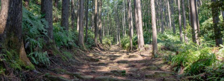
Forest, almost all of it. Cedar and cypress with older mixed woodland higher up, and the light through it is the thing people remember. The trail surface is earth, roots and a great deal of stone, and the old paving is slippery in rain, so the descents are harder work than the climbs. The signage is excellent and the Nakahechi is genuinely difficult to lose.
There is no technical difficulty anywhere on it. What there is: 5 to 9 miles a day, ascents of 1,000 to 2,000 feet, and four consecutive days of it. If you walk hills at home for three hours without much thought, you will be fine.
Accommodation, and being honest about it
You sleep in minshuku, family-run guesthouses in villages along the route, with dinner and breakfast included and both usually excellent. Rooms are Japanese style: futons on tatami, thin walls, shared bathrooms in most places, and a hot bath you take in a set order. That is the experience rather than a compromise, and our article on ryokan etiquette covers the bathing order and the yukata, which apply here too.
Two things to plan around. Capacity on the route is tiny, perhaps a dozen rooms in a village, so peak season books out six to nine months ahead. And some minshuku still prefer cash, so we tell you how much to carry before you leave the last town with a bank machine.
Luggage moves ahead of you by the local transfer service, so you walk with a daypack. On the Nakahechi this works reliably. On the Kohechi and the Iseji it works in fewer places, which is another reason those routes are harder.
The two nights that make the trip are not on the trail at all: a temple lodging on Koyasan at the start, with a vegetarian shojin ryori dinner and morning prayers at six, and Yunomine Onsen after the long day, a hot spring village in continuous use for about 1,800 years where you can bathe in a tiny wooden bathhouse over the source.
Season, plainly
April and May. Our first choice. Fresh green, comfortable temperatures, everything open. Late April carries Golden Week, which we plan around.
Late October and November. Our other first choice. Autumn colour, cool clear air and the best walking conditions of the year. It coincides with the Kyoto autumn wave, so book early. See Kyoto in autumn.
June. The rainy season on the Kii peninsula, which is one of the wettest places in Japan. The forest in rain is atmospheric and the stone paving is genuinely slippery. We will build it if you want it and we will tell you what you are choosing.
July and August. Hot, humid and heavy going, with leeches in wet sections. Not the season for this walk.
December to March. Walkable in the lower sections, cold, quiet and beautiful, with occasional snow on the passes and some accommodation closed for the winter. A good choice for an experienced walker who wants absolute solitude.
Rain is common in every season here. We provide a wet weather plan and the bus alternatives for each section, so a bad day changes the walk rather than ending it.
How it fits into a Japan trip
The Kumano Kodo needs four to six days including the transfers in and out, which means it belongs on a trip of fourteen days or more. The shape we build most often frames it with Tokyo and Kyoto at the front and Osaka or Kanazawa at the back, which is walking the Kumano Kodo in 16 days.
If you have twelve days, walk two sections rather than four, keep Koyasan and Yunomine, and lose nothing that matters.
What it costs
A walking week sits close to our comfortable Japan anchor of $285 per person per day, land only, because the minshuku nights with two meals included are cheaper than city hotels while the transfers and the Koyasan temple lodging are not. The full cost picture is in what two weeks in Japan really costs.
Plan this trip
Tell us your dates and the places you want to see, and we build your trip as a $39 day-by-day plan, with recommended hotels by level and every transfer set out step by step.
Keep reading
- Walking the Kumano Kodo, 16 days
- Japan: the complete guide to planning your trip
- Ryokan etiquette, without the anxiety
- Kyoto in autumn, week by week
- How much does two weeks in Japan really cost?
- All our Japan trips